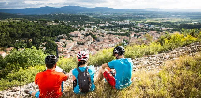
Grande Traversée du Massif Central Gravel


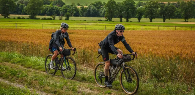
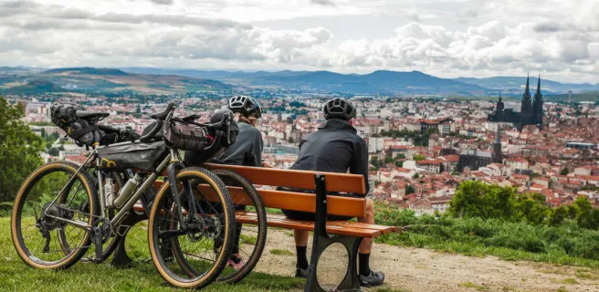
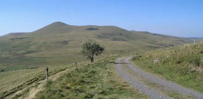
The "Grande Traversée du Massif central Gravel" offers a version of the mountain bike route suitable for gravel bikes. Based on the mountain bike route, it bypasses all the technical sections for an easier route. Ideal for gravel, or even loaded mountain bikes! Discover the Massif Central: the mountains and lakes of Morvan, the volcanoes of Auvergne, the Cévennes National Park, the immense plateaus of the Grands Causses, and then the beaches of the Mediterranean sea! A real adventure on paths, trails and unfrequented roads, to share with friends, family or solo! Here you'll find all the information you need to embark on this unforgettable adventure. Please note that bypasses are not signposted, so make sure you have a gpx track.
Gradients and elevation
France's largest mountain bike itinerary now adapted for gravel riding
All you need to know about the Grande Traversée du Massif Central:
- 1430 km from the Morvan to the Mediterranean
- 5 natural parks crossed
- 30,000 meters of vertical ascent
- Numerous entry and exit points along the route
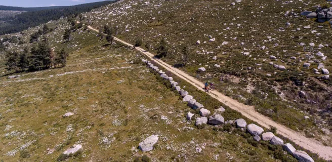
- A 100% gravel-compatible route
A less technical version of the MTB route
At the request of mountain bikers, a diagnosis of the gravel-accessibility of the MTB route was undertaken. Based on this data, variants have been proposed to get around all the technical difficulties of the route, while staying as close as possible to the MTB route in order to take advantage of the services available around it.
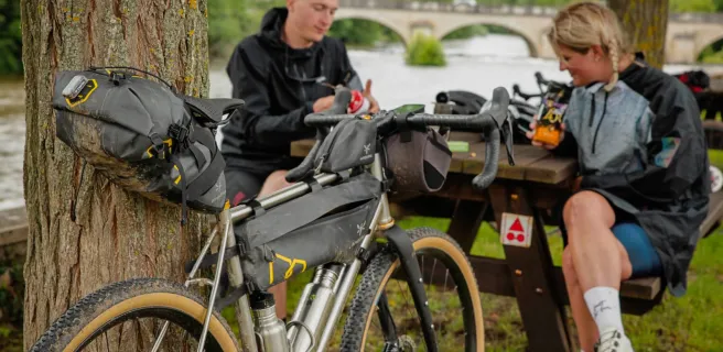
As the suggested bypasses are not signposted, we strongly advise you to have the GPX track on your GPS or mobile phone to help you find your way around and enjoy the scenery.
While technical difficulties are avoided, the gradient remains substantial. The GTMC Gravel is a sporty route, which everyone can complete at their own pace.
Trains and transport on the route
View infrastructure on the map
Reviews for Grande Traversée du Massif Central Gravel
"Accueil Vélo" accommodation on Grande Traversée du Massif Central Gravel
231 Accueil Vélo accommodations await you on Grande Traversée du Massif Central Gravel!
View accommodations on the map
The 31 stages of Grande Traversée du Massif Central Gravel

1 Avallon / Quarré-les-Tombes
2 Quarré-les-Tombes / Saulieu

3 Saulieu / Montsauche-les-Settons

4 Montsauche-les-Settons / Anost

5 Anost / La Grande-Verrière

8 La Grande-Verrière / Toulon-sur-Arroux

10 Toulon-sur-Arroux / Bourbon-Lancy

11 Bourbon-Lancy / Moulins
Here, the landscapes vary between hedge-divided fields, forests and a multitude of small lakes. A final stretch beside the Allier River, a major tributary of the Loire, takes you to the historic city of Moulins, capital of the Bourbonnais and historic headquarters of this northern section of the Auvergne Region.
12 Moulins / Chantelle
Next, you ascend to plateaux planted with vineyards in the Saint-Pourçain wine-making area. Verneuil-en-Bourbonnais, a charming, characterful village, offers an ideal place to rest your studded tyres! Cross the steep-sided, refreshing Bouble Gorges to reach Chantelle and its abbey.
13 Chantelle / Riom
Then follow the Sioule River as far as Ebreuil, tackling a fairly hilly portion of route. The rest of this stage offers you more and more expansive views onto the volcanoes, captivating you all the way. Coming down to the flat Limagne agricultural plain, the views prove particularly wonderful, with the historic town of Riom and the iconic Puy de Dôme volcano looking splendid.
14 Riom / Clermont-Ferrand
15 Clermont-Ferrand / Volvic
Cycling in these parts, your gaze will be irresistibly drawn to the volcanoes. The stage ends at the little town of Volvic, famed for its mineral water naturally filtered through volcanic rock.
16 Volvic / Laschamps
After the town of Volvic, you start along a stretch of road before you get down to the real cycling business, guided along very good tracks in the direction of the Puy de Chopine volcano.
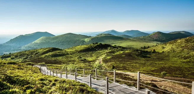
Here, in the midst of the Chaîne des Puys volcanic range, the countryside is both magnificent and exceptional, with splendid views to admire.
17 Laschamps / Murol
18 Murol / Saint-Alyre-ès-Montagne
19 Saint-Alyre-ès-Montagne / Chalinargues
Relish the wonderfully long descent that ensues, lasting 6km! As you reach the end of the route through the Cézallier, you enter the département of Cantal. After Pradiers and Les Veyrines Waterfall, it’s Allanche next. Leaving that village, a slope takes you up to La Pinatelle Wood. Riding along broad forest tracks, you soon reach Chalinargues.

20 Chalinargues / Ruynes-en-Margeride

22 Ruynes-en-Margeride / Domaine du Sauvage

23 Domaine du Sauvage / Baraque des Bouviers
Consider a detour to Sainte-Eulalie, with its Bison Reserve, by following the GTMC VTT mountain-biking course towards St-Chély-d'Apcher.

26 Baraque des Bouviers / Bagnols-les-Bains
28 Bagnols-les-Bains / Le Pont-de-Montvert
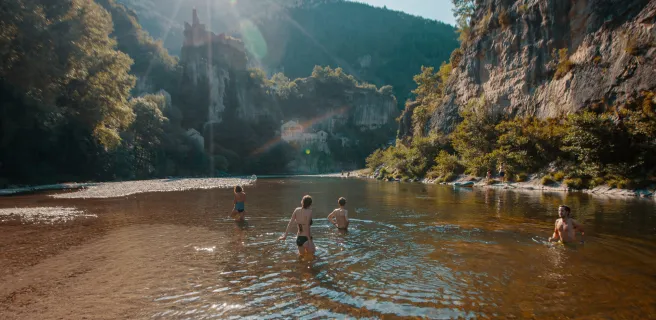
29 Le Pont-de-Montvert / Sainte-Enimie

30 Sainte-Enimie / L'Hom
You cross several hamlets, and as the stage is relatively easy, you can make the most of the views, including some magnificent viewing points, both over the Causse and to the Massif de l'Aigoual mountain range.

31 L'Hom / L'Esperou
As to the summit of the Mont Aigoual, this is the high point of the whole route, in all senses! On really clear days, you can take in virtually a quarter of France, from the mighty Mont Blanc in the Alps to the Mont Canigou in the Pyrenees, with the Cantal Volcano somewhere inbetween! Plus, in really good weather, you can even spot the Mediterranean from up here, for the first time on the
GTMC route.

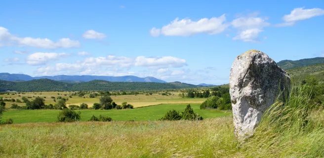
32 L'Esperou / Le Vigan
You’re now travelling through the département of the Gard and as you cross typical, well-maintained villages, you can enjoy gorgeous views over the Southern Cévennes. You pass close to the Lac des Pises, well worth a detour. This stage leads you mainly along wide tracks, but you may at times have to put a foot to the ground or even push your gravel bike. For the final stretch to the town of Le Vigan, you ride along a converted railway line, with a few tunnels to cycle through, some better lit than others.
33 Le Vigan / Blandas

34 Blandas / La Couvertoirade

36 La Couvertoirade / Lunas
Consider visiting Labeil Cave before entering the mysterious L’Escandorgue Forest. A Buddhist temple and lovely views of the Haut Languedoc’s mountains mark the way before you plunge down into the Gravezon Valley, where you’ll discover Joncels Abbey. Lunas makes a refreshing stop, with its fine river and an outdoor leisure centre based around a pretty lake.

37 Lunas / Clermont-l'Hérault
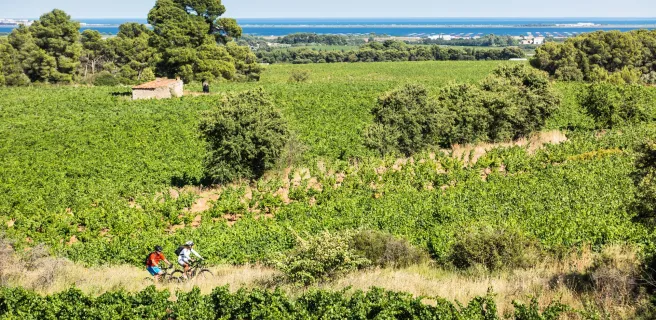
Some of our favourite spots: Dio and its château; Carlencas Plateau; and, above all, Le Salagou Lake. The last is a perfect spot for mountain bikers. The lakeside offers beautiful, enjoyable singletracks plus many possibilities for going for a dip. Vineyards and olive groves complete the landscapes around here. Then you reach the town of Clermont l’Hérault, with its many facilities.
38 Clermont-l'Hérault / Montagnac