Virginie et William
VIrginie et William
William et Virginie

L'aventure au coin du chemin

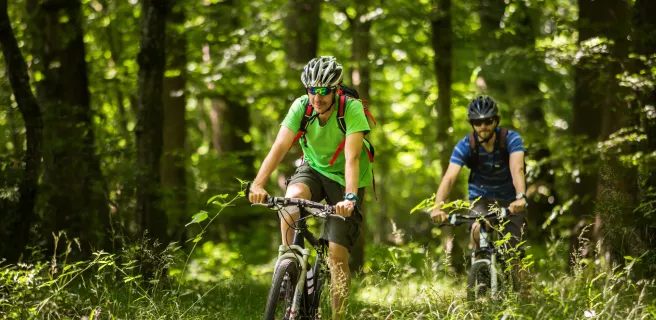
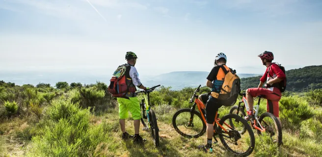
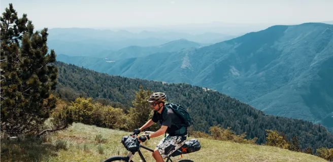
Virginie et William ont parcouru la GTMC en autonomie d’Avallon à Agde au mois de juillet 2021. Le challenge sportif et l’attrait de la nature ont guidé leur choix. Résultat : quinze jours intenses! Voici leurs impressions

La variété des paysages au fil des kilomètres

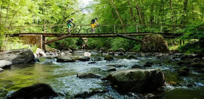
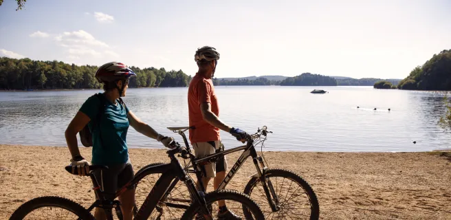
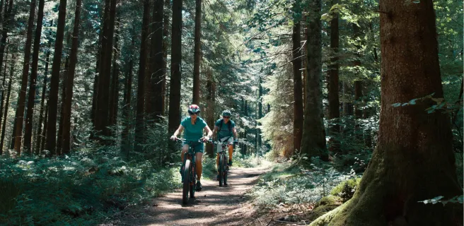
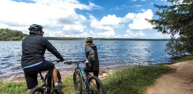
Les 1400 kilomètres de la GTMC offrent une diversité de paysages étonnante. Nous avons découvert les forêts majestueuses du Morvan, région surnommée à juste titre « le Canada français » du fait de ses grands lacs et de ses forêts de sapins. Le lac des Settons, fin d’une des étapes, est un spot magnifique. Grande émotion de lever le nez sur la cime d’un sequoia en pleine nature.
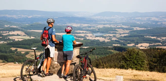
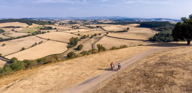
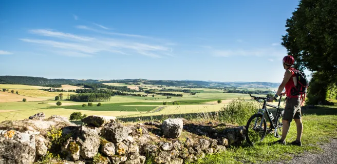
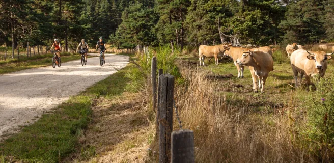
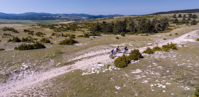
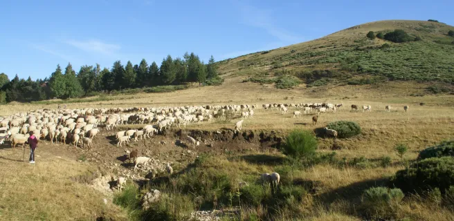
La partie traversant l’Allier est un peu morne et peut se faire en accéléré, cela vous permettra d’arriver dans le Puy de Dôme et de profiter d’une succession d’étapes dans des coins somptueux. Les plateaux auvergnats depuis lesquels vous pourrez contempler les anciens volcans en compagnie des vaches font partie de nos coups de coeur. Vous surplomberez le lac Pavin et ses eaux turquoise niché dans un ancien cratère.
La Lozère est le trait d’union entre le massif central et la France méridionale. Les contreforts montagneux commencent à sentir bon la garrigue ! Nous avons beaucoup aimé l’ascension du mont Mouchet (1500 m), haut lieu de la résistance, qui offre une ligne de crête exceptionnelle permettant d’admirer le paysage sur ses deux versants.
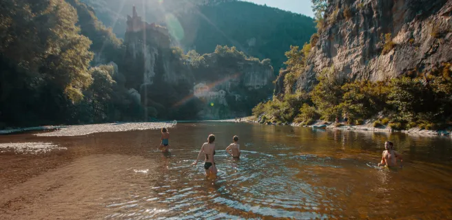
La trace nous fait ensuite plonger vers les gorges du Tarn où nous avons découvert le joli village de Saint-Enimie enchâssé dans un ravin de 600 mètres. Très spectaculaire. Tellement spectaculaire que nous avons choisi l’option route pour y arriver (de nuit). Si vous souffrez du vertige faites bien attention à l’itinéraire que vous empruntez car dans ce secteur - à partir des gorges du Tarn et durant tout le passage dans les Cévennes – les chemins et routes sont très escarpés. C’est beau mais ça se mérite. Malheureusement, les trombes d’eau nous ont obligé à faire l’impasse sur l’ascension du mont Aigoual et le cirque de Navacelles.
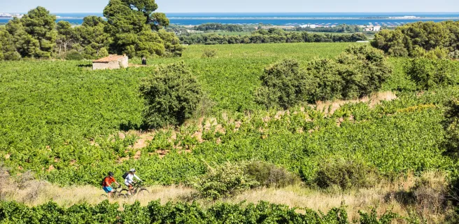
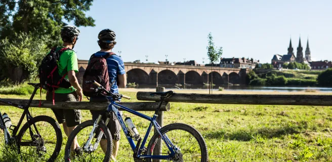
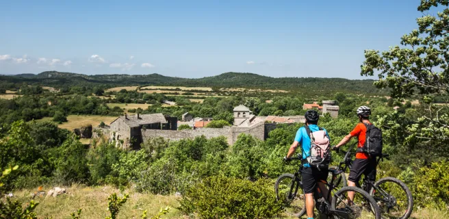
En continuant, les chemins en terre rouge annoncent le sud ! Nous sommes arrivés en fin de journée au lac du Salagou, une pépite à découvrir dans la lumière déclinante du jour. William s’est bien amusé dans les bosses de ce temple du VTT. La suite de la trace vous mènera à travers les vignobles de l’Hérault pour finalement aboutir à Agde sur la pointe de la corniche. Evidemment, quand on arrive face à la Méditerranée après quinze jours aussi intenses, les larmes montent vite aux yeux.

Col de Ceyssat

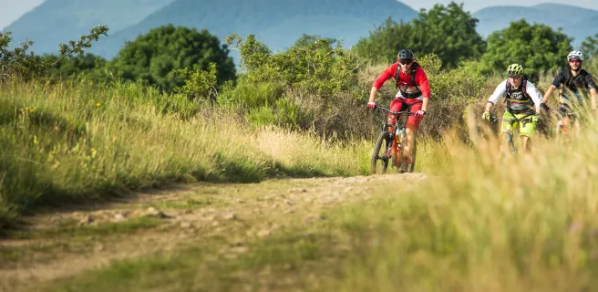
Le tracé : attention au ravitaillement

Premier conseil : si vous avez la possibilité de vous faire déposer à Avallon c’est quand même la solution la plus confortable. En effet, le départ de la GTMC est difficile d’accès en train, le réseau ferré centralisé à la française ne propose que des départs de Paris à la gare de Bercy. Habitant dans les Landes, nous avons eu la chance de trouver une âme généreuse prête à faire 700 km pour nous déposer (encore merci à celui qui se reconnaîtra) !
Nous avons suivi les étapes en les adaptant de temps à autre notamment du fait d’une météo capricieuse. Regardez bien où sont prévues les arrivées de certains tronçons, certaines étapes s’achèvent dans des coins très isolés, mieux vaut avoir prévu de quoi manger et se préparer à dormir dehors si le temps le permet.
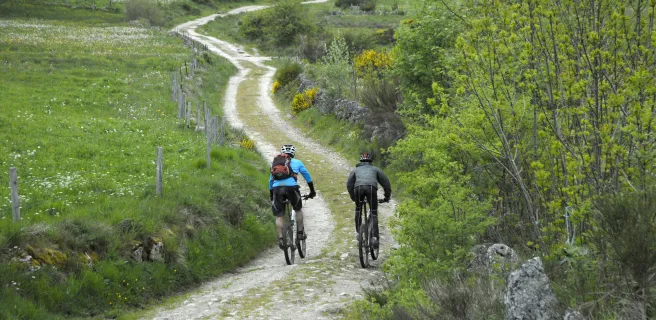
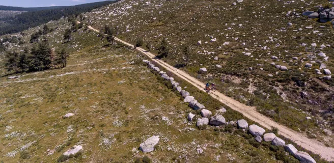
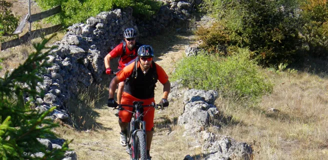
Le début et la fin de la trace sont les plus techniques (le Morvan et à partir du lac du Salagou). Les intempéries des mois précédents et peut-être le manque d’entretien des chemins lié aux confinements successifs ont rendu de nombreux chemins impraticables et complétement ravinés. C’est particulièrement le cas dans le Morvan, pays d’eau où certains chemins étaient transformés en rivières. Conclusion : nous avons perdu beaucoup de temps dans le premier tiers de la GTMC avec beaucoup de portage de vélos (chargés). Deuxième conclusion : si vous hésitiez à prendre votre gravel, pour nous, ce tracé est définitivement un tracé VTT.


La GTMC, c’est pour qui ?


  • Les sportifs : Si vous décidez de la faire en entier d’Avallon à Agde, mieux vaut être entraînés et habitués à l’effort prolongé. Nous vous conseillons d’être le plus léger possible, une cariole par exemple ne passe pas sur la plupart des chemins. Pour notre part, nous avons fait 1100 km en quinze jours avec 17 000 D+. Il faut aussi avoir l’esprit d’aventure, s’adapter en permanence…et aimer le pâté (notre nourriture de base) !
  • Les aventuriers : Ne sachant pas à quel rythme nous avancerions, nous avons voyagé en autonomie. Pour dormir, nous avions un tarp, une toile que nous posons sur nos vélos retournés. Ce système permet de voyager léger et de s’installer rapidement. En revanche en cas de pluie, c’est insuffisant pour bien se protéger. Quand il pleuvait nous avons trouvé des abris en dur ou hébergements. Pratiquer le bivouac a pour avantage de pouvoir s’arrêter quand on le souhaite et surtout, de vivre l’aventure en France !
  • Les altruistes : Le voyage en vélo permet de lier connaissance, les gens viennent facilement vous parler et sont souvent admiratifs de l’effort sportif. Cela nous a valu de très belles rencontres et même de dormir chez l’habitant.

selfie en duo

Nos bons plans

  • A Quarré les Tombes (Yonne) : boulangerie exceptionnelle ! C’est bon et ultra copieux. La première boulangerie de France qui fait dire à William : « Je vais en garder pour plus tard ».
  • A Saint-Genès-Champanelle (Puy de Dôme) : Archipel Volcan, une auberge où nous avons trouvé refuge autour d’une belle planche fromage / charcuterie pendant un orage. Ils font également hôtel. Accueil cycliste friendly.
  • A Ruynes-en-Margerides (Lozère) : camping le Petit bois. Joli camping calme disposant d’une pinède.
  • A Arzanc de Randon (Lozère) : Le gîte d’étape tenu par la famille Amarger. Nous n’y avons pas dormi mais pris un café et Marie nous a fait visiter les lieux. Ce gîte est ouvert en permanence, ce qui est bien pratique ! (Et attention au gîte de la Barraque des Bouviers, 15 km en amont de la trace, qui ferme à 17h ! Cela nous a valu une nuit à la belle étoile revigorante par 7° !).
  • A Sainte-Enimie (Lozère) : Bar restaurant Le petit Paris. Ils servent de 8h à 23h, une rareté quand on est en bike trip ! Et en plus, ils sont très sympas.
  • Au Caylar (Hérault) : la pluie nous a obligé à trouver un hébergement, nous vous recommandons Co’Gite, un gîte tenu par Céline et Xavier, un moniteur de VTT et sa compagne. Lieu confortable, abordable et accueil sympa.
  • Au lac du Salagou (Hérault) : Le Mas de Riri. Camping côté sud du lac qui permet de profiter de la belle lumière de la soirée et de boire une bière devant un très beau panorama. Accueil très sympa.


Custom route

Custom route

Avallon / Quarré-les-Tombes

1 Avallon / Quarré-les-Tombes

52 km
5 h 30 min
Hard
The Grande Traversée du Massif Central (GTMC) mountain bike route begins at Avallon, at the northern end of the Parc du Morvan, in central Burgundy. Explore Avallon’s historic centre, then descend on your mountain bike, via steep terraced gardens, to follow the Cousin upstream, cycling along its wild, steep-sided valley. Continuing south through hedge-divided fields, you reach the Lac du Crescent, one of the six ‘great lakes’ of the Morvan Range. After the dam at L’Huis Raquin, enjoy a detour of under 5km (there and back) to admire the imposing Château de Chastellux, dating back to the 11th century. This stage offers a solid introduction to the granite range of the Morvan Hills!
Quarré-les-Tombes / Saulieu

2 Quarré-les-Tombes / Saulieu

46 km
4 h 45 min
Hard
Once you’ve taken a good look at the 112 stone sarcophagi scattered around Quarré-les-Tombes Church, the GTMC leads you along a section offering a string of spots with remarkable views. This stage provides the attractions of a hearty mountain-bike outing, plus the odd highlight along the way, such as the Forêt au Duc and the Benedictine Abbey of La Pierre qui Vire. The way is made all the prettier for being dotted with lakes of different sizes; in particular, you’ll cycle beside Saint-Agnan Lake, and the lakes by the Maison du Parc. The tracks through light woods offer very good sliding thrills… on a mountain bike!
Saulieu / Montsauche-les-Settons

3 Saulieu / Montsauche-les-Settons

34 km
3 h 00 min
Average
At the start of this stage, you’re plunged back to the start of the 20th century, the mountain-bike route following the former rail line that linked Saulieu to Corbigny via the slow Le Tacot train. Then enjoy a pleasant stretch dotted with hamlets set between patchworks of fields and small portions of hardwood forest. The route also takes you beside Chamboux Lake, the youngest of the Morvan’s great lakes. Stop to observe the many aquatic birds here, including kingfishers, crested grebes and grey herons. Get back on your bike to reach the edge of Settons Lake, cycling via an easy-rolling path, the highlight of this GTMC stage.
Montsauche-les-Settons / Anost

4 Montsauche-les-Settons / Anost

53 km
5 h 30 min
Hard
The natural scenery changes on this stage of the GTMC à VTT as you pick up altitude. All along the way, enjoy the lovely ‘windows’ onto the surrounding landscapes of the Morvan Central area, with its green hills. The route continues through pine forests, with Douglas firs and spruce growing alongside the inevitable Christmas trees! In the centre of Ouroux, just 150m from the church, don’t miss the viewing point belvedere. From here, admire the panorama across to the Morvan’s largest lake, the Lac de Pannecière Chaumard.
Anost / La Grande-Verrière

5 Anost / La Grande-Verrière

51 km
5 h 30 min
Very hard
On this stage, mountain bikers follow in the footsteps of ‘galvachers’ – in the 19th century, these small-scale transport specialists crossed the Morvan Range and plains beyond on ox-drawn carts. In these parts, beautiful paths neatly crisscross the forests, where you’ll be struck by the extraordinary shapes of some of the trees. Cycle up the Haut Folin Massif, Burgundy’s crowning point, then the track to Glux-en-Glenne plunges you back down into lovely, atmospheric stretches. On the final portion, the descent via La Grande-Verrière is a delight, offering lovely views westwards in clear weather.
La Grande-Verrière / Toulon-sur-Arroux

7 La Grande-Verrière / Toulon-sur-Arroux

59 km
6 h 15 min
Hard
This stage marks the end of the Grande Traversée du Morvan à VTT. You leave behind the fairly elevated slopes of the Morvan Range to arrive in gentler, undulating countryside, the way running between green hedges. Do take the time to take in the landscapes, which have a hint of Tuscany about them. There are many places en route offering lovely views on this stage of the GTMC à VTT.
Toulon-sur-Arroux / Bourbon-Lancy

10 Toulon-sur-Arroux / Bourbon-Lancy

50 km
5 h 00 min
Hard
The GTMC by mountain bike here alternates between stretches on paths and on quiet country roads. There are many points from which you can admire the Bocage Bourbonnais, with its hedge-divided fields. Don’t miss the short detour by bike to the top of Mont Dardon, at an altitude of 506m – in very clear conditions, you may even spot the summit of the iconic Mont Blanc, a vast distance away! Take a refreshing break at Montperroux Lake, then head on to the Signal du Mont and its tower-cum-belvedere, 10m in height. Complete this stage with a long descent to Bourbon-Lancy, a thermal spa resort with a medieval heart, including the Quartier de l’Horloge, with its memorable belfry.
Bourbon-Lancy / Moulins

11 Bourbon-Lancy / Moulins

78 km
6 h 15 min
Average
This GTMC by mountain bike stage between the towns of Bourbon-Lancy and Moulins takes you into the French county of Allier, former heartland of the powerful Bourbon family. Having crossed the mighty Loire, enjoy very easy riding through the Sologne Bourbonnaise area.
Here, the landscapes vary between hedge-divided fields, forests and a multitude of small lakes. A final stretch beside the Allier River, a major tributary of the Loire, takes you to the historic city of Moulins, capital of the Bourbonnais and historic headquarters of this northern section of the Auvergne Region.
Moulins / Chantelle

12 Moulins / Chantelle

64 km
4 h 19 min
Hard
This undulating GTMC à VTT stage presents cyclists with a variety of landscapes and atmospheres, plus you’re afforded the first staggering views of the Auvergne’s volcanic ranges. First, though, you cross Moladier Forest, then join the banks of the Allier.
Next, you ascend to plateaux planted with vineyards in the Saint-Pourçain wine-making area. Verneuil-en-Bourbonnais, a charming, characterful village, offers an ideal place to rest your studded tyres! Cross the steep-sided, refreshing Bouble Gorges to reach Chantelle and its abbey.
Chantelle / Riom

13 Chantelle / Riom

58 km
5 h 15 min
Hard
Continuing along the GTMC à VTT from Chantelle to Riom, the volcanic range of the Chaîne des Puys stands temptingly in your line of vision. You quickly reach Charroux, a member of the association Les Plus Beaux Villages de France, with many craftspeople based here.
Then follow the Sioule River as far as Ebreuil, tackling a fairly hilly portion of route. The rest of this stage offers you more and more expansive views onto the volcanoes, captivating you all the way. Coming down to the flat Limagne agricultural plain, the views prove particularly wonderful, with the historic town of Riom and the iconic Puy de Dôme volcano looking splendid.
Riom / Clermont-Ferrand

14 Riom / Clermont-Ferrand

26 km
2 h 45 min
Hard
Having crossed the village of Marsat, you enter a wonderful stretch of countryside. As you head up into the hills, enjoy the varied views, onto the Limagne Plain, Riom and Clermont-Ferrand, the last with its cathedral built from black volcanic stone and the test circuits for the Michelin tyre company famously based in the city. At Chateaugay, cellars line up, carved into the basalt rock, recalling the long wine-making past of this village. After you’ve scaled Le Bancillon Pass, dip down into the lively centre of the Auvergne’s historic and administrative capital, Clermont-Ferrand.
Clermont-Ferrand / Volvic

15 Clermont-Ferrand / Volvic

20 km
2 h 00 min
Hard
Historic Clermont-Ferrand was formerly the starting point for the original GTMC mountain bike route. From town, you head gradually up to the Chaîne des Puys Range, distinguished by its 80 volcanoes and dominated by the largest, the massively impressive Puy de Dôme. Admire the exceptionally varied landscapes below the Puy de Dôme, going from the 2,000-year-old city to sunny slopes planted with vines and fruit trees. This stage ends amidst chestnut woods and ancient volcanic flows, which have given rise to distinctive vegetation and architecture.
Cycling in these parts, your gaze will be irresistibly drawn to the volcanoes. The stage ends at the little town of Volvic, famed for its mineral water naturally filtered through volcanic rock.
Volvic / Laschamps

16 Volvic / Laschamps

36 km
4 h 00 min
Hard
This stage takes you along highly enjoyable stretches, through a series of charming villages and landscapes, leading you into the Chaîne des Puys volcanic range. Leaving Volvic, you enter volcano territory, the route taking you towards the Puy de Chopine along very good cycling tracks. Admire the magnificent, rare natural setting in the heart of the Chaîne des Puys - the views are absolutely splendid.
Saint-Genès-Champanelle / Murol

17 Saint-Genès-Champanelle / Murol

46 km
4 h 45 min
Hard
After Laschamps, the GTMC by mountain bike leads you along splendid paths up to Orcival via Recoleine. Visit the Basilique Notre-Dame-des-Fers, a major Romanesque church. The route then leads you gradually up into the Massif du Sancy, another major Auvergne range. Consider picnicking beside Servières Lake before crossing the vast summer pastures on high, which impart a wonderful sense of freedom. A pretty, lightly wooded stretch takes you to Pessade, a resort perfect for outdoor pursuits thanks to its fine natural setting. The end of the stage offers the highlight of Lac Chambon, the Massif du Sancy as backdrop. You may well be tempted by a dip in the lake!
Murol / Saint-Alyre-ès-Montagne

18 Murol / Saint-Alyre-ès-Montagne

40 km
4 h 15 min
Hard
The views along this stage are magnificent, while the atmosphere changes dramatically along the way. After admiring the very beautiful medieval village of Besse, head on to the exceptional circular Pavin Lake, set in a volcano crater. Next comes Montcineyre Lake, a crescent-shaped volcanic lake. You’ve now entered the Cézallier area. Here, steep slopes are replaced by gentler, more rounded ones, the vast stretches of high summer pastures dotted with herds of cows. La Godivelle Nature Reserve preserves precious peat-bogs. Admire the Lacs d’En-Haut et d’En Bas before arriving at the hamlet of Jassy.
Saint-Alyre-ès-Montagne / Chalinargues

19 Saint-Alyre-ès-Montagne / Chalinargues

40 km
4 h 15 min
Hard
Leaving Jassy, the GTMC leads you up to the Col du Mont Chamaroux pass, then this pastoral track takes you to the summit of a plateau perched at 1,450m above sea level. From on high, admire the vast views of the Sancy Range and the volcanic French county of Cantal.
Relish the wonderfully long descent that ensues, lasting 6km! As you reach the end of the route through the Cézallier, you enter the département of Cantal. After Pradiers and Les Veyrines Waterfall, it’s Allanche next. Leaving that village, a slope takes you up to La Pinatelle Wood. Riding along broad forest tracks, you soon reach Chalinargues.
Chalinargues / Ruynes-en-Margeride

20 Chalinargues / Ruynes-en-Margeride

51 km
5 h 15 min
Hard
From Chalinargues, the GTMC route heads down to Neussargues, for a short stretch taking you along a singletrack that is quite technically demanding. Except for the Combe Robert and Le Sailhant slopes, crossing the Planèze area then proves fairly peaceful and comfortable, leading you up to the historic centre of Saint-Flour (awarded Ville et Pays d'Art et d'Histoire status, in recognition of its rich history). You come down from this Windy City, perched on its rocky promontory, to reach the lower town, cycling beside the Ander River for a time. Then continue through typical hedge-divided fields, past woods and meadows, to reach Ruynes-en-Margeride.
Ruynes-en-Margeride / Chanaleilles

22 Ruynes-en-Margeride / Chanaleilles

49 km
5 h 15 min
Hard
After Ruynes en Margeride, tackle the slopes up to Trailus. After that, you have to climb to the Col du Signal. The reward is a path along the crests that allows for more comfortable riding, leading you to the summit of Mont Mouchet (1,497m above sea level), renowned for its links with the French Resistance in World War II. You now enter the French county of Haute-Loire, descending to Paulhac en Margeride, in the next county of Lozère. The forest tracks cutting through these wooded, granite parts lead to the Domaine du Sauvage, a Knights Templar estate in medieval times and a significant stopping point on the Santiago de Compostela pilgrimage route.
Domaine du Sauvage / Baraque des Bouviers

23 Domaine du Sauvage / Baraque des Bouviers

12 km
1 h 15 min
Average
Continue across the Margeride area on the GTMC, going through wooded parts, but from the patches of meadows you can enjoy distant glimpses of the heights of the Aubrac, the Cantal, the Devès and the Ardèche Plateau.
Consider a detour to Sainte-Eulalie, with its Bison Reserve, by following the GTMC link towards St-Chély-d'Apcher.
Baraque des Bouviers / Bagnols-les-Bains

27 Baraque des Bouviers / Bagnols-les-Bains

60 km
5 h 45 min
Very hard
The GTMC by mountain bike leads you up to the Col des Trois Soeurs pass, after which you can enjoy the lovely descent to reach the little village of Le Giraldès, typical of the French county of Lozère. Next, you ascend to the Col du Cheval Mort and the Truc de Fortunio. The descent that follows takes you down to pretty Charpal Lake, at the end of the section through the Margeride area. Now you’re ready to explore your first Causse (or limestone plateau) along the GTMC, Montbel Causse. In fact, on this stage, you also set eyes on the Upper Lot Valley, finishing this portion at the little thermal resort of Bagnols-les-Bains, where a tired mountain biker might just indulge in a little pampering!
Bagnols-les-Bains / Le Pont-de-Montvert

28 Bagnols-les-Bains / Le Pont-de-Montvert

45 km
4 h 30 min
Hard
Well-maintained GTMC tracks take you up to the summits of the mighty Mont Lozère, surrounded by high summer pastures and copses of Scots pines. Next, enjoy magnificent views from a balcony of a stretch of track, the panorama sometimes opening up to the south, sometimes to the north, with the Margeride area you may just have cycled through. While the route doesn’t take in the summits of the Mont Lozère themselves, you pass close by, before reaching the Col de Finiels, a pass at one of the highest points along the whole of the GTMC – 1,541m above sea level.
Enjoy the lovely pastoral atmosphere along this stage, taking you through isolated hamlets, the high summer pastures close to the source of the Tarn River, and the first stretches of the Tarn, marked by waterfalls and water holes. Finally, you arrive at the character-filled village of Le Pont de Montvert.
Le Pont-de-Montvert / Sainte-Enimie

29 Le Pont-de-Montvert / Sainte-Enimie

57 km
6 h 15 min
Very hard
This GTMC by mountain bike stage starts with a narrow ascent, accompanied by views down on the dramatic Gorges du Tarn. You’re heading up to one of the high Causses. Next, you descend to the bottom of a valley, the route taking you past the magnificent collegiate church of Bédouès, to reach Florac, little capital of the wild Cévennes Region. After that, the GTMC meanders along the banks of the Upper Tarn, crossing the river on several occasions to reach the very pretty villages of Ispagnac, Quézac and, finally, Sainte-Enimie, the last at the end of this stage. Please note: both the start and end of this stage can be tricky to negotiate (see details below).
Sainte-Enimie / Fraissinet-de-Fourques

30 Sainte-Enimie / Fraissinet-de-Fourques

28 km
3 h 45 min
Very hard
Continue cycling beside the Tarn using a track that is in parts perched quite high and technically demanding (see details below) to reach St Chely du Tarn, located on a meander in the river. A narrow, dramatic route then leads up to the Col de Coperlac, taking you up to the Causse Méjean, the highest of the Causse plateaux, its highest point 1,247m above sea level. On high, the cycling flows easily, allowing you to survey your surroundings as you cross several hamlets and to enjoy magnificent views over the Causse and the Aigoual Range.
L'Hom / L'Esperou

31 L'Hom / L'Esperou

27 km
3 h 30 min
Very hard
The GTMC leaves behind the Causse as you enter the Aigoual Range. At the Col de Perjuret, take in the breath-taking views of the Jonte Gorges. The route then makes you climb through the national Forest of L’Aigoual, following the path of a draille, a route taken by herds to get up to and down from the high summer pastures. Now you reach the highest point along the whole GTMC route, the summit of L’Aigoual, 1,567m above sea level, with a major meteorological observatory on the top. This is the high point of the whole route in all senses! The views from here are truly exceptional on clear days, allowing you to take in virtually a quarter of France, from the mighty Mont Blanc in the Alps to the Mont Canigou in the Pyrenees, with the Cantal Volcano somewhere inbetween! On really clear days, you can even spot the Mediterranean from up here, for the first time on the GTMC route.
L'Esperou / Le Vigan

32 L'Esperou / Le Vigan

38 km
4 h 00 min
Very hard
You’re greeted by a lot of elevations as the GTMC à VTT enters the French county of Gard. At least with the 1,000m you need to climb, you can enjoy spectacular views across the Southern Cévennes Range, dotted with typically unspoilt villages such as Salagosse, Mars, Bréau, Esparon, Molières or Avèze. Special mention should be made of the arrival at the town of Le Vigan, through narrow streets, along easy singletracks, and via riverside paths. Also enjoy the challenging descents along this stage, in large part on singletrack paths.
Le Vigan / Blandas

33 Le Vigan / Blandas

36 km
4 h 30 min
Very hard
After Le Vigan, the first part of this GTMC à VTT stage takes you through forests. Reaching Montdardier, the landscape changes, becoming more open, with wide stretches of prairie land where no trees or shrubs grow – you’ve reached the Causse de Blandas, marked out by its megaliths and old grazing and farming traditions. Continue on to a Grand Site de France, the Cirque de Navacelles, a staggering natural bowl of land formed by a meander, and the highlight along this stage. The Blandas belvederes, located at the heart of a protected natural zone covering 46 hectares, offer four different, stunning views down on the Cirque de Navacelles and the Vis Gorges.
Blandas / La Couvertoirade

34 Blandas / La Couvertoirade

39 km
3 h 30 min
Very hard
Linking Blandas, Vissec and Alzon, the Vis Valley was once an important way, in centuries past. Here, where three Causses meet – those of Blandas, Campestre and Le Larzac – take in their typical arid, rocky terrain. You enter the French county of Aveyron via the Col de la Barrière and the village of Sauclières with its cobbled streets known as calades. Following the GTMC, you climb up, via a former railway line, to the Larzac Plateau, at the heart of the Parc Naturel Régional des Grands Causses, the landscapes here part of a UNESCO World Heritage Site covering the Causses and Cévennes. Passing via the height of Le Puech du Bassel (at 916m), enjoy the 360° view on offer. Finally, you arrive at La Couvertoirade, once a Knights Templar, then a Knights Hospitaller stronghold, now a village that is part of the association Les Plus Beaux Villages de France!
La Couvertoirade / Lunas

36 La Couvertoirade / Lunas

55 km
4 h 30 min
Hard
Leaving the Larzac behind, the GTMC takes you into the Parc Naturel Régional du Haut Languedoc. The village of Le Caylar en Larzac is full of surprises, surrounded by box bushes and ancient stone statues, with a remarkable sculpted tree too. The place serves as a good stopping point.
Consider visiting Labeil Cave before entering the mysterious L’Escandorgue Forest. A Buddhist temple and lovely views of the Haut Languedoc’s mountains mark the way before you plunge down into the Gravezon Valley, where you’ll discover Joncels Abbey. Lunas makes a refreshing stop, with its fine river and an outdoor leisure centre based around a pretty lake.
Lunas / Clermont-l'Hérault

37 Lunas / Clermont-l'Hérault

42 km
4 h 00 min
Hard
After Lunas, the GTMC route leads you into clearly Mediterranean terrain. The hilly way here allows riders to make the most of some exceptional views, over the great expanses of the Haut Languedoc and then over the curious red earth around Le Salagou Lake.
Some of our favourite spots: Dio and its château; Carlencas Plateau; and, above all, Le Salagou Lake. The last is a perfect spot for mountain bikers. The lakeside offers beautiful, enjoyable singletracks plus many possibilities for going for a dip. Vineyards and olive groves complete the landscapes around here. Then you reach the town of Clermont l’Hérault, with its many facilities.
Clermont-l'Hérault / Montagnac

38 Clermont-l'Hérault / Montagnac

58 km
5 h 30 min
Hard
On this last really sporty stage of the GTMC, you go slaloming along alternating tracks and paths taking you down the final southern slopes of the Massif Central. You then plunge into an ocean of vines as you ride to the lovely little town of Pézenas, closely linked to the great 17th-century French dramatist Molière. There are lovely views over to the Pic de Vissou, guardian hill at the centre of the French county of Hérault, plus panoramas across vine-covered plains to the Med, and even to the Pyrenees on clear days. What with the vines and olive trees, the lovely stone villages and the wineries, you really feel you’ve reached the South of France!
Montagnac / Agde

39 Montagnac / Agde

59 km
5 h 00 min
Average
The final stage on the GTMC à VTT route offers some nice surprises. The first part of this stage is enjoyable as well as beautiful, taking you from Montagnac to Castelnau-de-Guers. You’ll ride along lovely paths, between pine woods and vines, with views to the Etang de Thau lagoon on one side and the Mediterranean on the other. The GTMC adopts part of a local route entitled "Terroir d’Art et de Nature de Montagnac", dotted with sculptures and statues. It’s then a very gentle ride along vineyard paths, quiet country roads, and cycle tracks. You can take your time now, taking in the vine-covered terrain and the ancient city of Agde, crossed by the Canal du Midi, before you join the Med along the only stretch of volcanic shoreline in the Languedoc.