La GTMC de Volvic à Pézenas en VTTAE

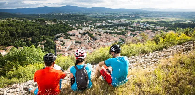
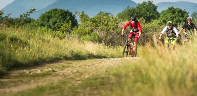
Il raconte son périple d'août 2018 à VTTAE sur la GTMC

Partant de Volvic, au-dessus de Clermont Ferrand, j'ai fini mon parcours à Pézenas, à quelques kilomètres de la Méditerranée.

Cela faisait un moment que je voulais partir sur la GTMC, et la réactualisation de cette traversée, en 2018, a été pour moi le déclencheur.


Des paysages uniques

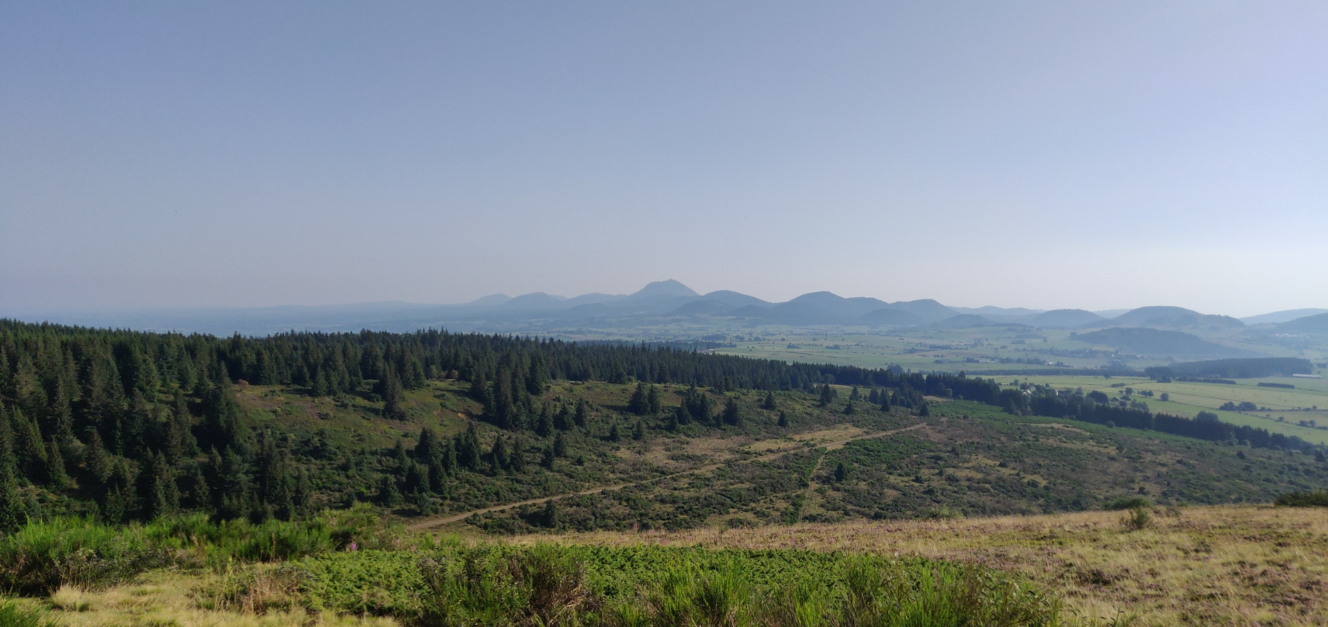
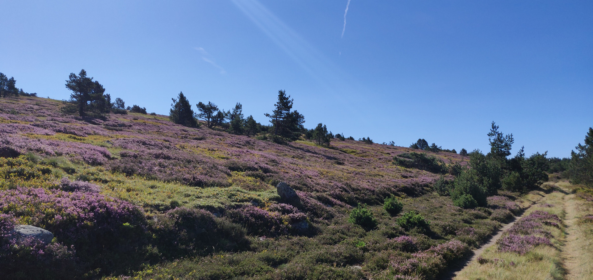
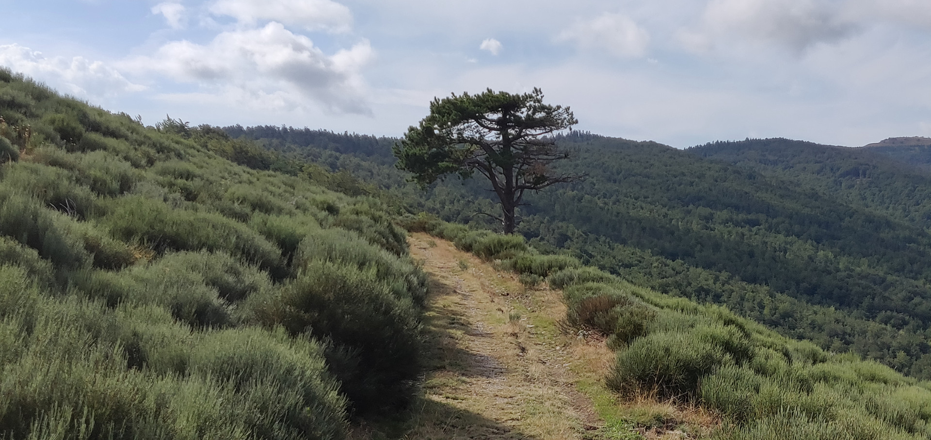
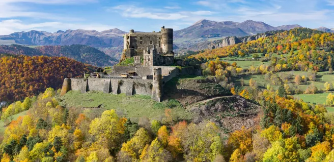
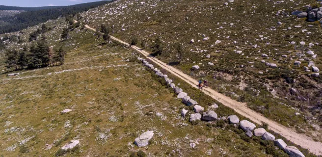
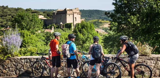
J'ai été absolument emballé par les paysages sensationnels que j'ai pu voir tout au long de ce voyage. D'abord l'Auvergne, ses volcans et ses lacs, ensuite la Margeride et le Cézallier, puis la Lozère et le Finiels, Le Causse Méjean, les Cévennes avec l'Aigoual et le cirque de Navacelles en terminant par L'Hérault et le lac du Salagou.

Si vous êtes épris de grands espaces, foncez, la GTMC est pour vous.

Grand paysage sur la GTMC

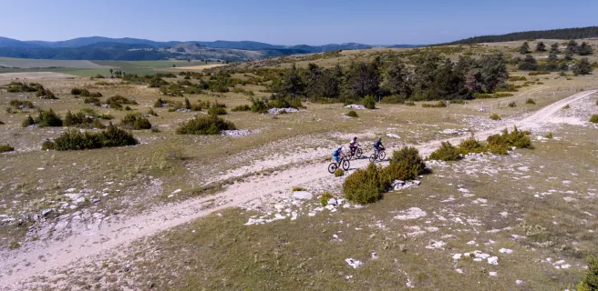
Personnellement, j'avais choisi de partir "longtemps", car j'avais déjà testé, à plusieurs reprises, des balades sur quelques jours. Je me suis donc fixé un parcours sur douze étapes.


12 jours c'est « long », surtout seul. Mais c'est le défi que je m'étais donné. Et hormis quelques douleurs au fondement, j'ai pris un grand plaisir, à rouler sur tous types de chemins, mais aussi à échanger, avec les randonneurs croisés sur les chemins ou dans les gîtes.


De riches rencontres...

Les rencontres sur ce genre de parcours sont souvent marrantes mais parfois plus poignantes.

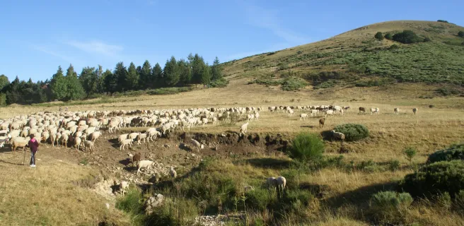
Je ne suis pas près d'oublier cet échange avec un berger sur les contreforts du Mont Lozère.

Le loup avait attaqué son troupeau pour la deuxième fois en quelques jours et voir ce grand gaillard avec une cartouchière autour du torse, presque en larmes en évoquant ses brebis disparues, m'a profondément ému.

Bruyère au Mont Lozère - GTMC VTT

J'ai aussi souvenir d'une belle soirée au bar de Chanaleilles, le Café du Pont, à souper avec des pèlerins de Compostelle en évoquant des souvenirs de marche à quelques encablures du bar ou se tenait des figures de la « France profonde », passablement éméchés, mais toujours bon enfant.

Chemins sur la GTMC

Et une expérience personnelle

Un jour après l'autre, il s'est installé un rythme, jalonné par des moments de doute, où je me demandais ce que je faisais là, comme par exemple, lors de la rude montée au Mont Mouchet, sous une pluie battante, dans le froid et la brume ; mais ces passages difficiles ont vite été effacés par des instants de grâce et de pure euphorie ou je me suis surpris à chanter à tue-tête.

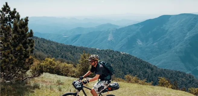
Le fait de rouler sur un VTTAE permet de limiter les efforts physiques et le plaisir du partage et du « savourage » l'emporte sur le défi physique.

Un des grands intérêts de la GTMC, c'est aussi de pouvoir choisir un tronçon et une durée suivant son envie et ses disponibilités. On peut partir rouler un weekend, quatre jours ou un mois. Le parcours, s’il peut être exigeant physiquement, n’est pas compliqué techniquement. Pour les puristes, il pourra être parcouru « en autonomie » et pour ceux qui ont besoin d’un peu plus de confort ou d’une prise de courant, il est possible de choisir gîte ou hôtel, en aménageant son parcours.


Personnellement, si je devais y retourner pour juste quelques jours, je choisirais la première partie, de Clermont Ferrand jusqu'à Saint Flour. On y trouve en effet tout ce qui fait le charme de ce parcours : le plaisir de rouler dans les grands espaces.

Custom route

Custom route

Volvic / Laschamps

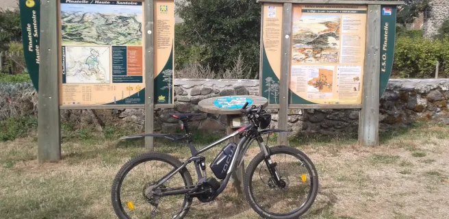
16 Volvic / Laschamps

36 km
4 h 00 min
Hard
This stage takes you along highly enjoyable stretches, through a series of charming villages and landscapes, leading you into the Chaîne des Puys volcanic range. Leaving Volvic, you enter volcano territory, the route taking you towards the Puy de Chopine along very good cycling tracks. Admire the magnificent, rare natural setting in the heart of the Chaîne des Puys - the views are absolutely splendid.
Saint-Genès-Champanelle / Murol

17 Saint-Genès-Champanelle / Murol

46 km
4 h 45 min
Hard
After Laschamps, the GTMC by mountain bike leads you along splendid paths up to Orcival via Recoleine. Visit the Basilique Notre-Dame-des-Fers, a major Romanesque church. The route then leads you gradually up into the Massif du Sancy, another major Auvergne range. Consider picnicking beside Servières Lake before crossing the vast summer pastures on high, which impart a wonderful sense of freedom. A pretty, lightly wooded stretch takes you to Pessade, a resort perfect for outdoor pursuits thanks to its fine natural setting. The end of the stage offers the highlight of Lac Chambon, the Massif du Sancy as backdrop. You may well be tempted by a dip in the lake!
Murol / Saint-Alyre-ès-Montagne

18 Murol / Saint-Alyre-ès-Montagne

40 km
4 h 15 min
Hard
The views along this stage are magnificent, while the atmosphere changes dramatically along the way. After admiring the very beautiful medieval village of Besse, head on to the exceptional circular Pavin Lake, set in a volcano crater. Next comes Montcineyre Lake, a crescent-shaped volcanic lake. You’ve now entered the Cézallier area. Here, steep slopes are replaced by gentler, more rounded ones, the vast stretches of high summer pastures dotted with herds of cows. La Godivelle Nature Reserve preserves precious peat-bogs. Admire the Lacs d’En-Haut et d’En Bas before arriving at the hamlet of Jassy.
Saint-Alyre-ès-Montagne / Chalinargues

19 Saint-Alyre-ès-Montagne / Chalinargues

40 km
4 h 15 min
Hard
Leaving Jassy, the GTMC leads you up to the Col du Mont Chamaroux pass, then this pastoral track takes you to the summit of a plateau perched at 1,450m above sea level. From on high, admire the vast views of the Sancy Range and the volcanic French county of Cantal.
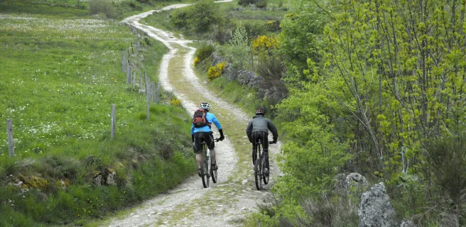
Relish the wonderfully long descent that ensues, lasting 6km! As you reach the end of the route through the Cézallier, you enter the département of Cantal. After Pradiers and Les Veyrines Waterfall, it’s Allanche next. Leaving that village, a slope takes you up to La Pinatelle Wood. Riding along broad forest tracks, you soon reach Chalinargues.
Chalinargues / Ruynes-en-Margeride

20 Chalinargues / Ruynes-en-Margeride

51 km
5 h 15 min
Hard
From Chalinargues, the GTMC route heads down to Neussargues, for a short stretch taking you along a singletrack that is quite technically demanding. Except for the Combe Robert and Le Sailhant slopes, crossing the Planèze area then proves fairly peaceful and comfortable, leading you up to the historic centre of Saint-Flour (awarded Ville et Pays d'Art et d'Histoire status, in recognition of its rich history). You come down from this Windy City, perched on its rocky promontory, to reach the lower town, cycling beside the Ander River for a time. Then continue through typical hedge-divided fields, past woods and meadows, to reach Ruynes-en-Margeride.
Ruynes-en-Margeride / Chanaleilles

22 Ruynes-en-Margeride / Chanaleilles

49 km
5 h 15 min
Hard
After Ruynes en Margeride, tackle the slopes up to Trailus. After that, you have to climb to the Col du Signal. The reward is a path along the crests that allows for more comfortable riding, leading you to the summit of Mont Mouchet (1,497m above sea level), renowned for its links with the French Resistance in World War II. You now enter the French county of Haute-Loire, descending to Paulhac en Margeride, in the next county of Lozère. The forest tracks cutting through these wooded, granite parts lead to the Domaine du Sauvage, a Knights Templar estate in medieval times and a significant stopping point on the Santiago de Compostela pilgrimage route.
Domaine du Sauvage / Baraque des Bouviers

23 Domaine du Sauvage / Baraque des Bouviers

12 km
1 h 15 min
Average
Continue across the Margeride area on the GTMC, going through wooded parts, but from the patches of meadows you can enjoy distant glimpses of the heights of the Aubrac, the Cantal, the Devès and the Ardèche Plateau.
Consider a detour to Sainte-Eulalie, with its Bison Reserve, by following the GTMC link towards St-Chély-d'Apcher.
Baraque des Bouviers / Bagnols-les-Bains

27 Baraque des Bouviers / Bagnols-les-Bains

60 km
5 h 45 min
Very hard
The GTMC by mountain bike leads you up to the Col des Trois Soeurs pass, after which you can enjoy the lovely descent to reach the little village of Le Giraldès, typical of the French county of Lozère. Next, you ascend to the Col du Cheval Mort and the Truc de Fortunio. The descent that follows takes you down to pretty Charpal Lake, at the end of the section through the Margeride area. Now you’re ready to explore your first Causse (or limestone plateau) along the GTMC, Montbel Causse. In fact, on this stage, you also set eyes on the Upper Lot Valley, finishing this portion at the little thermal resort of Bagnols-les-Bains, where a tired mountain biker might just indulge in a little pampering!
Bagnols-les-Bains / Le Pont-de-Montvert

28 Bagnols-les-Bains / Le Pont-de-Montvert

45 km
4 h 30 min
Hard
Well-maintained GTMC tracks take you up to the summits of the mighty Mont Lozère, surrounded by high summer pastures and copses of Scots pines. Next, enjoy magnificent views from a balcony of a stretch of track, the panorama sometimes opening up to the south, sometimes to the north, with the Margeride area you may just have cycled through. While the route doesn’t take in the summits of the Mont Lozère themselves, you pass close by, before reaching the Col de Finiels, a pass at one of the highest points along the whole of the GTMC – 1,541m above sea level.
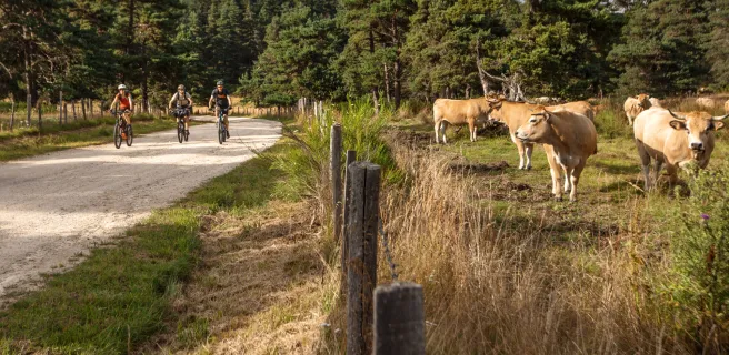
Enjoy the lovely pastoral atmosphere along this stage, taking you through isolated hamlets, the high summer pastures close to the source of the Tarn River, and the first stretches of the Tarn, marked by waterfalls and water holes. Finally, you arrive at the character-filled village of Le Pont de Montvert.
Le Pont-de-Montvert / Sainte-Enimie

29 Le Pont-de-Montvert / Sainte-Enimie

57 km
6 h 15 min
Very hard
This GTMC by mountain bike stage starts with a narrow ascent, accompanied by views down on the dramatic Gorges du Tarn. You’re heading up to one of the high Causses. Next, you descend to the bottom of a valley, the route taking you past the magnificent collegiate church of Bédouès, to reach Florac, little capital of the wild Cévennes Region. After that, the GTMC meanders along the banks of the Upper Tarn, crossing the river on several occasions to reach the very pretty villages of Ispagnac, Quézac and, finally, Sainte-Enimie, the last at the end of this stage. Please note: both the start and end of this stage can be tricky to negotiate (see details below).
Sainte-Enimie / Fraissinet-de-Fourques

30 Sainte-Enimie / Fraissinet-de-Fourques

28 km
3 h 45 min
Very hard
Continue cycling beside the Tarn using a track that is in parts perched quite high and technically demanding (see details below) to reach St Chely du Tarn, located on a meander in the river. A narrow, dramatic route then leads up to the Col de Coperlac, taking you up to the Causse Méjean, the highest of the Causse plateaux, its highest point 1,247m above sea level. On high, the cycling flows easily, allowing you to survey your surroundings as you cross several hamlets and to enjoy magnificent views over the Causse and the Aigoual Range.
L'Hom / L'Esperou

31 L'Hom / L'Esperou

27 km
3 h 30 min
Very hard
The GTMC leaves behind the Causse as you enter the Aigoual Range. At the Col de Perjuret, take in the breath-taking views of the Jonte Gorges. The route then makes you climb through the national Forest of L’Aigoual, following the path of a draille, a route taken by herds to get up to and down from the high summer pastures. Now you reach the highest point along the whole GTMC route, the summit of L’Aigoual, 1,567m above sea level, with a major meteorological observatory on the top. This is the high point of the whole route in all senses! The views from here are truly exceptional on clear days, allowing you to take in virtually a quarter of France, from the mighty Mont Blanc in the Alps to the Mont Canigou in the Pyrenees, with the Cantal Volcano somewhere inbetween! On really clear days, you can even spot the Mediterranean from up here, for the first time on the GTMC route.
L'Esperou / Le Vigan

32 L'Esperou / Le Vigan

38 km
4 h 00 min
Very hard
You’re greeted by a lot of elevations as the GTMC à VTT enters the French county of Gard. At least with the 1,000m you need to climb, you can enjoy spectacular views across the Southern Cévennes Range, dotted with typically unspoilt villages such as Salagosse, Mars, Bréau, Esparon, Molières or Avèze. Special mention should be made of the arrival at the town of Le Vigan, through narrow streets, along easy singletracks, and via riverside paths. Also enjoy the challenging descents along this stage, in large part on singletrack paths.
Le Vigan / Blandas

33 Le Vigan / Blandas

36 km
4 h 30 min
Very hard
After Le Vigan, the first part of this GTMC à VTT stage takes you through forests. Reaching Montdardier, the landscape changes, becoming more open, with wide stretches of prairie land where no trees or shrubs grow – you’ve reached the Causse de Blandas, marked out by its megaliths and old grazing and farming traditions. Continue on to a Grand Site de France, the Cirque de Navacelles, a staggering natural bowl of land formed by a meander, and the highlight along this stage. The Blandas belvederes, located at the heart of a protected natural zone covering 46 hectares, offer four different, stunning views down on the Cirque de Navacelles and the Vis Gorges.
Blandas / La Couvertoirade

34 Blandas / La Couvertoirade

39 km
3 h 30 min
Very hard
Linking Blandas, Vissec and Alzon, the Vis Valley was once an important way, in centuries past. Here, where three Causses meet – those of Blandas, Campestre and Le Larzac – take in their typical arid, rocky terrain. You enter the French county of Aveyron via the Col de la Barrière and the village of Sauclières with its cobbled streets known as calades. Following the GTMC, you climb up, via a former railway line, to the Larzac Plateau, at the heart of the Parc Naturel Régional des Grands Causses, the landscapes here part of a UNESCO World Heritage Site covering the Causses and Cévennes. Passing via the height of Le Puech du Bassel (at 916m), enjoy the 360° view on offer. Finally, you arrive at La Couvertoirade, once a Knights Templar, then a Knights Hospitaller stronghold, now a village that is part of the association Les Plus Beaux Villages de France!
La Couvertoirade / Lunas

36 La Couvertoirade / Lunas

55 km
4 h 30 min
Hard
Leaving the Larzac behind, the GTMC takes you into the Parc Naturel Régional du Haut Languedoc. The village of Le Caylar en Larzac is full of surprises, surrounded by box bushes and ancient stone statues, with a remarkable sculpted tree too. The place serves as a good stopping point.
Consider visiting Labeil Cave before entering the mysterious L’Escandorgue Forest. A Buddhist temple and lovely views of the Haut Languedoc’s mountains mark the way before you plunge down into the Gravezon Valley, where you’ll discover Joncels Abbey. Lunas makes a refreshing stop, with its fine river and an outdoor leisure centre based around a pretty lake.
Lunas / Clermont-l'Hérault

37 Lunas / Clermont-l'Hérault

42 km
4 h 00 min
Hard
After Lunas, the GTMC route leads you into clearly Mediterranean terrain. The hilly way here allows riders to make the most of some exceptional views, over the great expanses of the Haut Languedoc and then over the curious red earth around Le Salagou Lake.
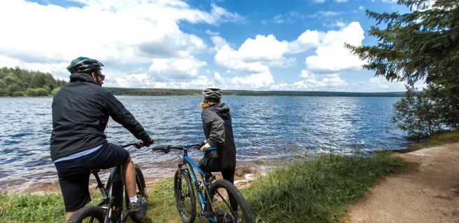
Some of our favourite spots: Dio and its château; Carlencas Plateau; and, above all, Le Salagou Lake. The last is a perfect spot for mountain bikers. The lakeside offers beautiful, enjoyable singletracks plus many possibilities for going for a dip. Vineyards and olive groves complete the landscapes around here. Then you reach the town of Clermont l’Hérault, with its many facilities.
Clermont-l'Hérault / Montagnac

38 Clermont-l'Hérault / Montagnac

58 km
5 h 30 min
Hard
On this last really sporty stage of the GTMC, you go slaloming along alternating tracks and paths taking you down the final southern slopes of the Massif Central. You then plunge into an ocean of vines as you ride to the lovely little town of Pézenas, closely linked to the great 17th-century French dramatist Molière. There are lovely views over to the Pic de Vissou, guardian hill at the centre of the French county of Hérault, plus panoramas across vine-covered plains to the Med, and even to the Pyrenees on clear days. What with the vines and olive trees, the lovely stone villages and the wineries, you really feel you’ve reached the South of France!