Domaine du Sauvage à VTT
Jules Grzyb - France Vélo Tourisme

800 km de VTT au cœur du Massif Central

8 jours sur la GTMC de Clermont-Fd à Agde

Jules nous raconte son périple sur la Grande Traversée du Massif Central à VTT réalisé à l'été 2019

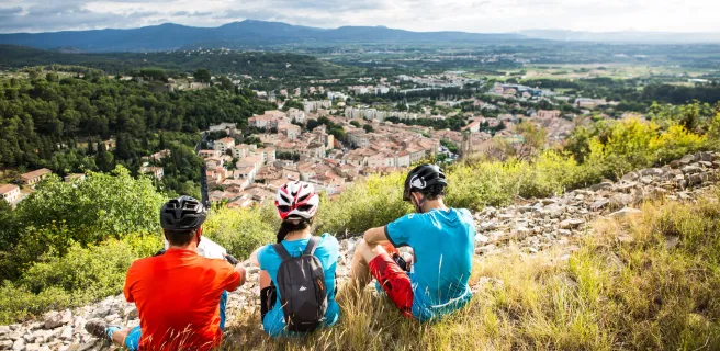
Une première "grande traversée" VTT pour lui, après plusieurs escapades et voyages en cyclorandonnée "classique" ainsi qu'en gravel. Une grande (et éprouvante !) semaine de Clermont-Ferrand jusqu'à la Méditerranée par la GTMC.

Au programme : du VTT évidemment, des bivouacs, des rencontres, de belles découvertes et bien d'autres !


Une aventure tout-terrain en autonomie

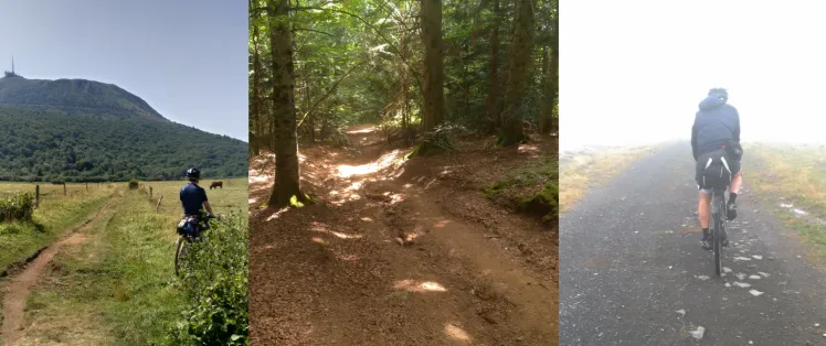
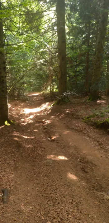
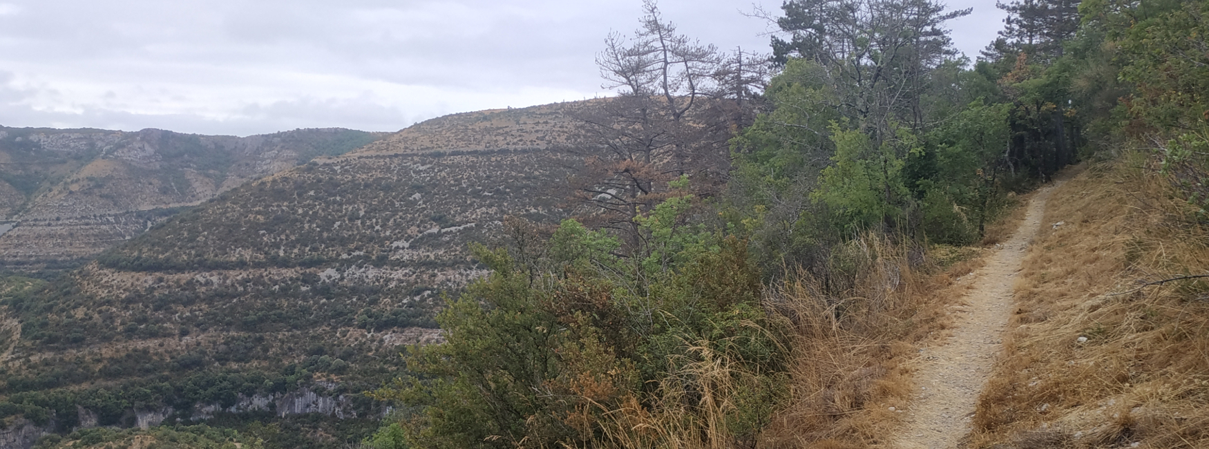
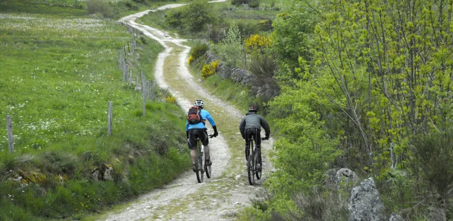
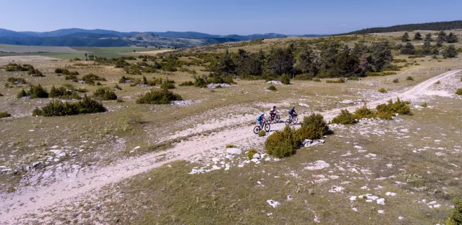
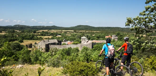
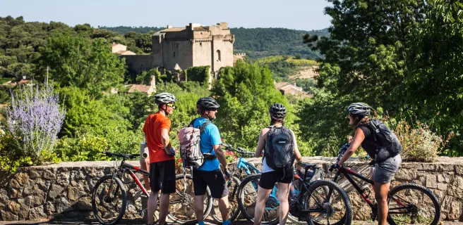
Une diversité de terrains et sentiers

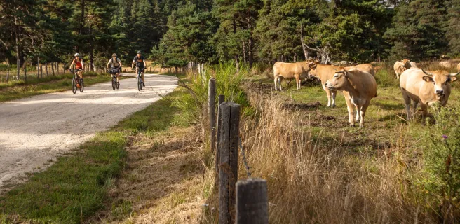
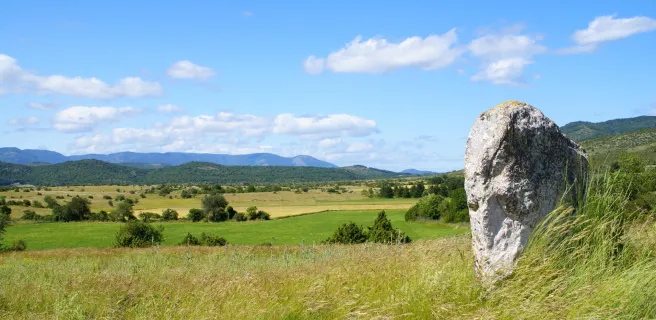
La GTMC est un itinéraire VTT varié, tant par les nombreux terrains et environnements traversés (volcans, causses, forêts, estives, terres rouges du Salagou …) que par les types de chemins empruntés (sentiers gravel, monotraces à flanc de coteaux, pistes rocailleuses etc…). C’est clairement un atout : on ne se lasse jamais !

Paysage GTMC

Quelques portions sur routes peuvent peut-être faire peur aux pures VTTistes endurcis : ça ne m'a pas posé de soucis, la piste reste dominante sur la plupart des étapes et les quelques passages sur asphalte se déroulent sans encombre sur des petites routes à faible trafic, ce qui permet de souffler un peu !

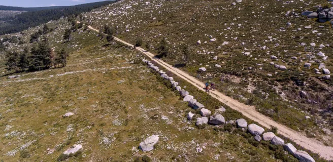
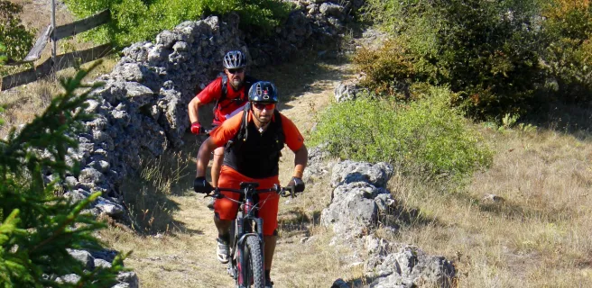
Un parcours plus ou moins technique selon les sections

Pas de mystère, comme son nom l'indique l'itinéraire traverse bien le Massif Central, et ça se sent, même si ce n'est pas les Alpes !

On monte pour redescendre, on regrimpe ensuite puis rebelote - en bref, ce n'est pas plat - et ça fait des dénivelés tout de même copieux ! 

VTT dans les gorges de la Vis

En termes techniques, n'ayant pas une grande expérience dans les zones montagneuses ( j'ai habitude du VTT en Picardie, ce n'est clairement pas le même type de terrains !), il y a certains passages où je me suis fais de petites frayeurs, sur des monotraces à flanc de coteaux, le long du Tarn notamment ..

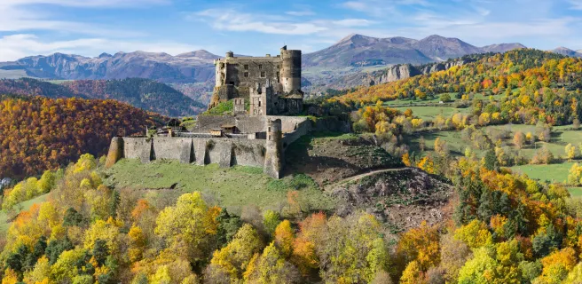
Clairement, le passage dans les Cévennes est le plus costaud selon moi, avec pour récompense des décors splendides

Orientation et suivi du tracé

Je n'ai pas eu besoin de GPS ou presque : il est tout à fait possible de parcourir l’itinéraire total en suivant les panneaux (même si un smartphone / les topoguides peuvent rester complémentaires et rassurants en cas de doute !).


Et niveau matériel ?

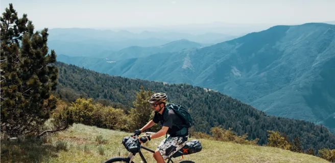
Le nerf de la guerre : le vélo, logique (!). Dans mon cas, c'était un VTT tout-rigide en acier et aux pneus larges, avec de nombreux oeillets permettant d'attacher des bagages (sur la fourche notamment) en plus de mes sacoches de bikepacking. Les suspensions ne m'ont pas manquées, compensées par les pneus qui "absorbaient" assez bien les vibrations. J'étais aussi content de ne pas être parti en vélo gravel, notamment lors de la traversée des Cévennes, loin d'être une section évidente !

Bikepacking VTT rigide sur la GTMC

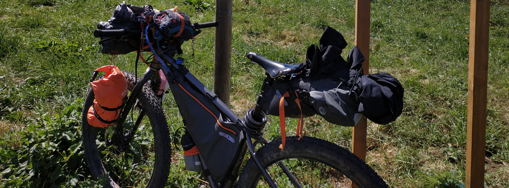
Je suis parti avec 3 grandes sacoches de bikepacking et 2 petits sacs sur la fourche :

  • Sacoche de cadre entière contenant mon eau (3L : amplement suffisant), les arceaux de ma tente et un vêtement de pluie
  • Sacoche de selle avec sac de couchage, chambres à air
  • Sacoche de guidon avec la tente (une grande de 2 places : bonheur !) et le matelas
  • Sacs sur la fourche, en vrac : vêtements, trousse de toilette, nourriture, électronique


A LIRE AUSSI : Le bikepacking, nouvelle façon de voyager à vélo ?


J'aurais sûrement pu gagner en poids avec une tente légère 1 place voire un bivy, en emportant moins d'eau, de vêtements, etc. : mais si j'avais à le refaire, je le referais sûrement dans ma configuration initiale, sans soucis !


Le parcours de Jules sur la GTMC


Récit détaillé : 

Bivouac sur la GTMC près de Saulzet-le-Froid
Jules Grzyb - France Vélo Tourisme

Jour 1 : Initiation dans les Puys

Clermont-Ferrand > Saulzet-le-Froid


Départ en trombe depuis la gare de Clermont, cap vers Volvic pour rejoindre ensuite la chaîne des Puys. On entre vite dans l'aspect "VTT" avec au menu : grimpettes, chemins et petits sentiers et quelques courtes sections sur routes !

Voguer sur des sentiers donne un réel sentiment de liberté par rapport à l'asphalte

Une étape sinusoïdale autour des volcans de la chaîne des Puys, ponctuée de charmants villages.

Le soir approchant, je découvre le splendide lac de Servière. Après hésitation d'y rester pour la nuit - l'endroit s'y prête parfaitement - je continue ma route sur quelques km pour être plus au calme. Un premier bivouac au frais mais l'aventure s'annonce très belle !

Lac de Saint-Alyre sur la GTMC VTT

Jour 2 : La journée des lacs

Saulzet-le-Froid > Coltines


Pour ce premier réveil sur la GTMC, tous les éléments sont avec moi : physique, mental, matériel et même la météo, tout suit ! Ça se confirme avec un doux petit déjeuner au Lac Chambon.

Je rate le Lac Pavin en allant trop vite, mais ma pause déj' à la Godivelle compense ce "raté" : rien de végétarien dans l'unique restaurant alors je grimpe pour grignoter au Lac d'en Haut, avec un cadre au top !

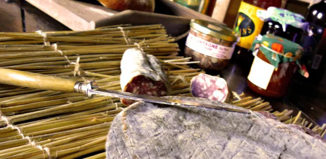
Mon végétarisme semble peu compatible aux habitudes gastronomiques locales. 

Ensuite, crochet au Lac de Saint-Alyre : agréable tronçon partagé avec une famille à VTT en vadrouille de 2 jours sur l'itinéraire.

Dîner à Neussargues avant le bivouac : on me propose une pizza végétarienne avec .. du thon (?!) - puis re-bivouac quelques km plus loin.

Domaine du Sauvage - GTMC VTT

Jour 3 : Framboises & Pèlerins

Coltines > Chanaleilles


Découverte de Saint-Flour sous la bruine; cap ensuite vers la Margeride où le Mont Mouchet y pointe le bout de son sommet.

Ça grouille de framboises, elles poussent de toute part des sentiers, je me régale - et ça durera 2 jours ! -

Redescente jusque Chanaleilles où la transition nature > "société" est radicale : une fête locale s'y tient et tous les habitants des villages alentours semblent avoir répondu à l'appel. Les tireuses font couler la bière à flot, l'huile transpire des baraques à frites et la musique bat son plein !


Je m'évade et retrouve une autre ambiance : les pèlerins au Domaine du Sauvage, avec qui je dîne avant de m'éclipser, guidé par les derniers rayons du soleil.

Margeride à VTT

Jour 4 : Dans les traces du Loup

Chanaleilles > Mont Lozère


Soleil de plomb aujourd'hui, l'accumulation de l'effort se fait un peu ressentir : pause du midi au Lac de Charpal, j'aurai bien envie de m'y baigner !

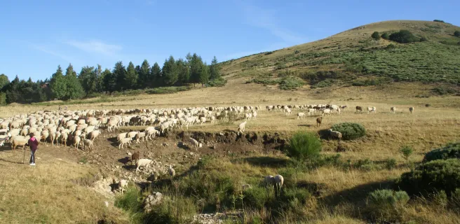
Les paysages sont splendides et la traversée de la Margeride est un moment de totale liberté dans des espaces immenses - on s'imagine bien le Gévaudan y rôder librement, cherchant sa future proie - !

Le VTT prend ici tout son sens, on enchaîne les sentiers dans de vastes étendues granitiques et de landes !

Arrivée "épique" à la frontale au mont Lozère par le sommet de Finiels; s'ensuit un face à face nocturne avec un âne, sûrement compagnon de route de randonneurs dormant paisiblement dans une tente juste à côté.

Gorges du Tarn à VTT - GTMC

Jour 5 : Chemin de Stevenson plutôt que GTMC : fausse bonne idée !

Mont Lozère > Causse Méjean


Réveil aux aurores pour admirer le lever de soleil au sommet du Mont Lozère puis cap vers le village de Pont-de-Montvert traversé par le Tarn. De nombreux marcheurs y passent pour suivre le chemin de Stevenson.


Pas de raison : je me prête aussi au "jeu" mimétique - de façon certes anachronique, avec mon vélo et mon équipement technique dernier cri - et tente de suivre ses traces. J'emprunte le GR pour sortir du village : une ascension pas roulante pour un sou mais au moins je m'en souviendrai ! 


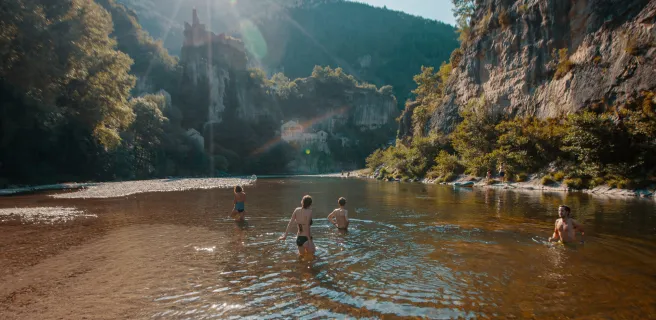
Retour sur la GTMC : là arrive le sentier le long des gorges du Tarn. Sacrée histoire ! Un chemin technique et à flanc de coteaux où la chute n'est pas envisageable avec une vue en contrebas impressionnante. On redescend régulièrement au niveau de la rivière et on peut s'y baigner aisément.

Éprouvant et magnifique jusqu'au bout, je quitte les gorges du Tarn à Sainte-Énimie pour une dernière grosse grimpette.

Mont Aigoual embrumé

Jour 6 : Après l'effort, le réconfort !

Causse Méjean > Rogues


Au menu du petit déjeuner : une longue et éprouvante ascension jusqu'au sommet du Mont-Aigoual recouverte d'une brume dense et bien humide. Le panorama sur les Cévennes, ce ne sera pas pour aujourd'hui !

La redescente de la face sud-ouest n'est pas aisée non plus, technique et rocailleuse à souhait, mais le plaisir de pilotage est total.


L'épreuve continue avec des monotraces en forêt qui ne cessent de grimper pour redescendre, le tout saupoudré de quelques poussages par endroits, sacrée étape décidément !  


Les paysages s'assèchent peu à peu vers le sud. J'atteins le village de Rogues juste avant un orage en approche. Une envie de confort (et de douche !) me prend : je trouve une yourte pour la nuit dans un cadre idyllique, dominant les gorges de la Vis. Ce sera ma première nuit hors tente - un repos du guerrier bien mérité - !

Cirque de Navacelles à VTT

Jour 7 : De Navacelles aux terres rouges du Salagou

Rogues > Nébian


Sortant de mon habitat mongole, je me fais accueillir par un troupeau de chevaux, puis après un copieux petit déjeuner, les single tracks du Cirques de Navacelles m'appellent.

Ce n'est pas une mince affaire, je n'en mène pas large : j'avais déjà découvert l'endroit à vélo de route mais l'ambiance n'est vraiment pas la même à VTT !


Je crois qu'à ce moment, je suis pressé d'arriver plus au sud, sortir de ce terrain de jeu splendide mais usant de par ses dénivelés et sa technicité !


Je rejoins Lunas et déjà, je me sens plus serein. Quelques temps après, la terre ocre annonce la couleur de l'arrivée au lac du Salagou : la fin de l'aventure semble commencer à poindre.

Arrivée à Agde - GTMC VTT

Jour 8 : Grand bleu & sable fin

Nébian > Agde


C'est le dernier jour, si tout se passe bien.

Je pars tôt et trace vers Agde, empruntant certaines portions de route pour rejoindre plus rapidement la mer : le temps semble se dégrader et je compte bien m'immerger dans le grand bleu avant que les nuages ne recouvrent le ciel.


J'y arrive, en trombe, comme lors de mon départ de Clermont le 1er jour. Tête dans le guidon, je ne réflechis pas et fonce à l'eau.


L'aventure se termine sans que je ne le réalise vraiment. Je crois que cette 1ère itinérance VTT en appellera d'autre. C'est même certain !

Custom route

Custom route

Clermont-Ferrand / Volvic

15 Clermont-Ferrand / Volvic

20 km
2 h 00 min
Hard
Historic Clermont-Ferrand was formerly the starting point for the original GTMC mountain bike route. From town, you head gradually up to the Chaîne des Puys Range, distinguished by its 80 volcanoes and dominated by the largest, the massively impressive Puy de Dôme. Admire the exceptionally varied landscapes below the Puy de Dôme, going from the 2,000-year-old city to sunny slopes planted with vines and fruit trees. This stage ends amidst chestnut woods and ancient volcanic flows, which have given rise to distinctive vegetation and architecture.
Cycling in these parts, your gaze will be irresistibly drawn to the volcanoes. The stage ends at the little town of Volvic, famed for its mineral water naturally filtered through volcanic rock.
Volvic / Laschamps

16 Volvic / Laschamps

36 km
4 h 00 min
Hard
This stage takes you along highly enjoyable stretches, through a series of charming villages and landscapes, leading you into the Chaîne des Puys volcanic range. Leaving Volvic, you enter volcano territory, the route taking you towards the Puy de Chopine along very good cycling tracks. Admire the magnificent, rare natural setting in the heart of the Chaîne des Puys - the views are absolutely splendid.
Saint-Genès-Champanelle / Murol

17 Saint-Genès-Champanelle / Murol

46 km
4 h 45 min
Hard
After Laschamps, the GTMC by mountain bike leads you along splendid paths up to Orcival via Recoleine. Visit the Basilique Notre-Dame-des-Fers, a major Romanesque church. The route then leads you gradually up into the Massif du Sancy, another major Auvergne range. Consider picnicking beside Servières Lake before crossing the vast summer pastures on high, which impart a wonderful sense of freedom. A pretty, lightly wooded stretch takes you to Pessade, a resort perfect for outdoor pursuits thanks to its fine natural setting. The end of the stage offers the highlight of Lac Chambon, the Massif du Sancy as backdrop. You may well be tempted by a dip in the lake!
Murol / Saint-Alyre-ès-Montagne

18 Murol / Saint-Alyre-ès-Montagne

40 km
4 h 15 min
Hard
The views along this stage are magnificent, while the atmosphere changes dramatically along the way. After admiring the very beautiful medieval village of Besse, head on to the exceptional circular Pavin Lake, set in a volcano crater. Next comes Montcineyre Lake, a crescent-shaped volcanic lake. You’ve now entered the Cézallier area. Here, steep slopes are replaced by gentler, more rounded ones, the vast stretches of high summer pastures dotted with herds of cows. La Godivelle Nature Reserve preserves precious peat-bogs. Admire the Lacs d’En-Haut et d’En Bas before arriving at the hamlet of Jassy.
Saint-Alyre-ès-Montagne / Chalinargues

19 Saint-Alyre-ès-Montagne / Chalinargues

40 km
4 h 15 min
Hard
Leaving Jassy, the GTMC leads you up to the Col du Mont Chamaroux pass, then this pastoral track takes you to the summit of a plateau perched at 1,450m above sea level. From on high, admire the vast views of the Sancy Range and the volcanic French county of Cantal.
Relish the wonderfully long descent that ensues, lasting 6km! As you reach the end of the route through the Cézallier, you enter the département of Cantal. After Pradiers and Les Veyrines Waterfall, it’s Allanche next. Leaving that village, a slope takes you up to La Pinatelle Wood. Riding along broad forest tracks, you soon reach Chalinargues.
Chalinargues / Ruynes-en-Margeride

20 Chalinargues / Ruynes-en-Margeride

51 km
5 h 15 min
Hard
From Chalinargues, the GTMC route heads down to Neussargues, for a short stretch taking you along a singletrack that is quite technically demanding. Except for the Combe Robert and Le Sailhant slopes, crossing the Planèze area then proves fairly peaceful and comfortable, leading you up to the historic centre of Saint-Flour (awarded Ville et Pays d'Art et d'Histoire status, in recognition of its rich history). You come down from this Windy City, perched on its rocky promontory, to reach the lower town, cycling beside the Ander River for a time. Then continue through typical hedge-divided fields, past woods and meadows, to reach Ruynes-en-Margeride.
Ruynes-en-Margeride / Chanaleilles

22 Ruynes-en-Margeride / Chanaleilles

49 km
5 h 15 min
Hard
After Ruynes en Margeride, tackle the slopes up to Trailus. After that, you have to climb to the Col du Signal. The reward is a path along the crests that allows for more comfortable riding, leading you to the summit of Mont Mouchet (1,497m above sea level), renowned for its links with the French Resistance in World War II. You now enter the French county of Haute-Loire, descending to Paulhac en Margeride, in the next county of Lozère. The forest tracks cutting through these wooded, granite parts lead to the Domaine du Sauvage, a Knights Templar estate in medieval times and a significant stopping point on the Santiago de Compostela pilgrimage route.
Domaine du Sauvage / Baraque des Bouviers

23 Domaine du Sauvage / Baraque des Bouviers

12 km
1 h 15 min
Average
Continue across the Margeride area on the GTMC, going through wooded parts, but from the patches of meadows you can enjoy distant glimpses of the heights of the Aubrac, the Cantal, the Devès and the Ardèche Plateau.
Consider a detour to Sainte-Eulalie, with its Bison Reserve, by following the GTMC link towards St-Chély-d'Apcher.
Baraque des Bouviers / Bagnols-les-Bains

27 Baraque des Bouviers / Bagnols-les-Bains

60 km
5 h 45 min
Very hard
The GTMC by mountain bike leads you up to the Col des Trois Soeurs pass, after which you can enjoy the lovely descent to reach the little village of Le Giraldès, typical of the French county of Lozère. Next, you ascend to the Col du Cheval Mort and the Truc de Fortunio. The descent that follows takes you down to pretty Charpal Lake, at the end of the section through the Margeride area. Now you’re ready to explore your first Causse (or limestone plateau) along the GTMC, Montbel Causse. In fact, on this stage, you also set eyes on the Upper Lot Valley, finishing this portion at the little thermal resort of Bagnols-les-Bains, where a tired mountain biker might just indulge in a little pampering!
Bagnols-les-Bains / Le Pont-de-Montvert

28 Bagnols-les-Bains / Le Pont-de-Montvert

45 km
4 h 30 min
Hard
Well-maintained GTMC tracks take you up to the summits of the mighty Mont Lozère, surrounded by high summer pastures and copses of Scots pines. Next, enjoy magnificent views from a balcony of a stretch of track, the panorama sometimes opening up to the south, sometimes to the north, with the Margeride area you may just have cycled through. While the route doesn’t take in the summits of the Mont Lozère themselves, you pass close by, before reaching the Col de Finiels, a pass at one of the highest points along the whole of the GTMC – 1,541m above sea level.
Enjoy the lovely pastoral atmosphere along this stage, taking you through isolated hamlets, the high summer pastures close to the source of the Tarn River, and the first stretches of the Tarn, marked by waterfalls and water holes. Finally, you arrive at the character-filled village of Le Pont de Montvert.
Le Pont-de-Montvert / Sainte-Enimie

29 Le Pont-de-Montvert / Sainte-Enimie

57 km
6 h 15 min
Very hard
This GTMC by mountain bike stage starts with a narrow ascent, accompanied by views down on the dramatic Gorges du Tarn. You’re heading up to one of the high Causses. Next, you descend to the bottom of a valley, the route taking you past the magnificent collegiate church of Bédouès, to reach Florac, little capital of the wild Cévennes Region. After that, the GTMC meanders along the banks of the Upper Tarn, crossing the river on several occasions to reach the very pretty villages of Ispagnac, Quézac and, finally, Sainte-Enimie, the last at the end of this stage. Please note: both the start and end of this stage can be tricky to negotiate (see details below).
Sainte-Enimie / Fraissinet-de-Fourques

30 Sainte-Enimie / Fraissinet-de-Fourques

28 km
3 h 45 min
Very hard
Continue cycling beside the Tarn using a track that is in parts perched quite high and technically demanding (see details below) to reach St Chely du Tarn, located on a meander in the river. A narrow, dramatic route then leads up to the Col de Coperlac, taking you up to the Causse Méjean, the highest of the Causse plateaux, its highest point 1,247m above sea level. On high, the cycling flows easily, allowing you to survey your surroundings as you cross several hamlets and to enjoy magnificent views over the Causse and the Aigoual Range.
L'Hom / L'Esperou

31 L'Hom / L'Esperou

27 km
3 h 30 min
Very hard
The GTMC leaves behind the Causse as you enter the Aigoual Range. At the Col de Perjuret, take in the breath-taking views of the Jonte Gorges. The route then makes you climb through the national Forest of L’Aigoual, following the path of a draille, a route taken by herds to get up to and down from the high summer pastures. Now you reach the highest point along the whole GTMC route, the summit of L’Aigoual, 1,567m above sea level, with a major meteorological observatory on the top. This is the high point of the whole route in all senses! The views from here are truly exceptional on clear days, allowing you to take in virtually a quarter of France, from the mighty Mont Blanc in the Alps to the Mont Canigou in the Pyrenees, with the Cantal Volcano somewhere inbetween! On really clear days, you can even spot the Mediterranean from up here, for the first time on the GTMC route.
L'Esperou / Le Vigan

32 L'Esperou / Le Vigan

38 km
4 h 00 min
Very hard
You’re greeted by a lot of elevations as the GTMC à VTT enters the French county of Gard. At least with the 1,000m you need to climb, you can enjoy spectacular views across the Southern Cévennes Range, dotted with typically unspoilt villages such as Salagosse, Mars, Bréau, Esparon, Molières or Avèze. Special mention should be made of the arrival at the town of Le Vigan, through narrow streets, along easy singletracks, and via riverside paths. Also enjoy the challenging descents along this stage, in large part on singletrack paths.
Le Vigan / Blandas

33 Le Vigan / Blandas

36 km
4 h 30 min
Very hard
After Le Vigan, the first part of this GTMC à VTT stage takes you through forests. Reaching Montdardier, the landscape changes, becoming more open, with wide stretches of prairie land where no trees or shrubs grow – you’ve reached the Causse de Blandas, marked out by its megaliths and old grazing and farming traditions. Continue on to a Grand Site de France, the Cirque de Navacelles, a staggering natural bowl of land formed by a meander, and the highlight along this stage. The Blandas belvederes, located at the heart of a protected natural zone covering 46 hectares, offer four different, stunning views down on the Cirque de Navacelles and the Vis Gorges.
Blandas / La Couvertoirade

34 Blandas / La Couvertoirade

39 km
3 h 30 min
Very hard
Linking Blandas, Vissec and Alzon, the Vis Valley was once an important way, in centuries past. Here, where three Causses meet – those of Blandas, Campestre and Le Larzac – take in their typical arid, rocky terrain. You enter the French county of Aveyron via the Col de la Barrière and the village of Sauclières with its cobbled streets known as calades. Following the GTMC, you climb up, via a former railway line, to the Larzac Plateau, at the heart of the Parc Naturel Régional des Grands Causses, the landscapes here part of a UNESCO World Heritage Site covering the Causses and Cévennes. Passing via the height of Le Puech du Bassel (at 916m), enjoy the 360° view on offer. Finally, you arrive at La Couvertoirade, once a Knights Templar, then a Knights Hospitaller stronghold, now a village that is part of the association Les Plus Beaux Villages de France!
La Couvertoirade / Lunas

36 La Couvertoirade / Lunas

55 km
4 h 30 min
Hard
Leaving the Larzac behind, the GTMC takes you into the Parc Naturel Régional du Haut Languedoc. The village of Le Caylar en Larzac is full of surprises, surrounded by box bushes and ancient stone statues, with a remarkable sculpted tree too. The place serves as a good stopping point.
Consider visiting Labeil Cave before entering the mysterious L’Escandorgue Forest. A Buddhist temple and lovely views of the Haut Languedoc’s mountains mark the way before you plunge down into the Gravezon Valley, where you’ll discover Joncels Abbey. Lunas makes a refreshing stop, with its fine river and an outdoor leisure centre based around a pretty lake.
Lunas / Clermont-l'Hérault

37 Lunas / Clermont-l'Hérault

42 km
4 h 00 min
Hard
After Lunas, the GTMC route leads you into clearly Mediterranean terrain. The hilly way here allows riders to make the most of some exceptional views, over the great expanses of the Haut Languedoc and then over the curious red earth around Le Salagou Lake.
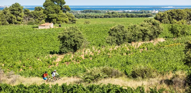
Some of our favourite spots: Dio and its château; Carlencas Plateau; and, above all, Le Salagou Lake. The last is a perfect spot for mountain bikers. The lakeside offers beautiful, enjoyable singletracks plus many possibilities for going for a dip. Vineyards and olive groves complete the landscapes around here. Then you reach the town of Clermont l’Hérault, with its many facilities.
Clermont-l'Hérault / Montagnac

38 Clermont-l'Hérault / Montagnac

58 km
5 h 30 min
Hard
On this last really sporty stage of the GTMC, you go slaloming along alternating tracks and paths taking you down the final southern slopes of the Massif Central. You then plunge into an ocean of vines as you ride to the lovely little town of Pézenas, closely linked to the great 17th-century French dramatist Molière. There are lovely views over to the Pic de Vissou, guardian hill at the centre of the French county of Hérault, plus panoramas across vine-covered plains to the Med, and even to the Pyrenees on clear days. What with the vines and olive trees, the lovely stone villages and the wineries, you really feel you’ve reached the South of France!
Montagnac / Agde

39 Montagnac / Agde

59 km
5 h 00 min
Average
The final stage on the GTMC à VTT route offers some nice surprises. The first part of this stage is enjoyable as well as beautiful, taking you from Montagnac to Castelnau-de-Guers. You’ll ride along lovely paths, between pine woods and vines, with views to the Etang de Thau lagoon on one side and the Mediterranean on the other. The GTMC adopts part of a local route entitled "Terroir d’Art et de Nature de Montagnac", dotted with sculptures and statues. It’s then a very gentle ride along vineyard paths, quiet country roads, and cycle tracks. You can take your time now, taking in the vine-covered terrain and the ancient city of Agde, crossed by the Canal du Midi, before you join the Med along the only stretch of volcanic shoreline in the Languedoc.

Découvrez également